Mueller Lake Park


The old Robert Mueller Municipal Airport air traffic control tower, built in 1961.

One of the places that I visit many times a week here in Austin, to walk and be in more of a natural setting is Mueller Lake Park. The park is a small part of the whole Mueller development which started after the old airport closed and moved out to the former location of Bergstrom Air Force Base, which closed in 1993. It seems like so long ago now, but I definitely remember taking flights out Robert Mueller Municipal Airport, and also visiting the airbase while in High School Air Force Jr ROTC. So much has changed in Austin since I first moved here in 1983 with my parents. It’s mostly unrecognizable compared to what it was back then.

Now at Mueller, where there used to be huge runways, a terminal, and parking lots, is a massive housing development, stores, parks, a children’s hospital, and various other venues. The plan for it has slowly been carried out and built over the last 20 years and seems to be getting near completion.


There are only a few artifacts left from the old airport opened in 1930, and rebuilt in 1961, which before that was farmland. There is a large bow-trussed hangar where they have the farmer’s market and a food court. And then there is the original air traffic control tower, which I think is an aesthetically interesting Jet Age structure. Back in 2012, the Austin Film Society hired me to photograph the tower to create an image for their Christmas card that year. I do hope the city does something cool with the tower eventually. So far it’s just been sitting alone in an empty field. We will see!

The 700-acre Mueller site, vacated when Austin’s airport relocated in 1999, is well on its way to becoming home to approximately 14,300 people, 14,500 employees, 10,500 construction jobs, 4 million square feet of office and retail, more than 6,200 homes and 140 acres of public open space. Mueller is an award-winning master planned and designed community, and in accordance with new urbanist principles.
— muelleraustin.com/about/

Out To Okeechobee

How I wish that I had better photos to share all that I saw today. I went on a half-day road trip out west from Palm Beach to Lake Okeechobee. The most interesting moment was driving by a sugar cane field with 15 foot high flames, a monstrous plume of smoke you could see for miles, and an almost alarming amount of heat that wafted into my open window as I drove by. After doing some research I discovered how controversial it is. If you are curious there are two recent articles that I found at the Claims Journal and the Miami Herald websites. According to one article, there are 400,000 acres of sugar cane in Florida. Wow!

DuPuis Management Area, Canal Point, FL.

My first stop was the DuPuis Management Area where I went on a short hike. When I got there the parking lot was empty but upon leaving there was a gentleman resting against the map and information stand. Was not expecting to meet a retired motorcycle enthusiast taking a rest on his daily ride out in the country. We had a nice conversation and he recommended that I check out “the lock” just down the road. The lock helps maintain the water level for Lake Okeechobee, Florida’s 730 square mile Inland Sea, as boats leave or enter the canal to and from the lake. There’s a canal cut across the entire state to allow small boats passage. Turns out the Port Mayaca Lock & Dam is one of the few places you can get a good look at the lake since it is mostly hidden by a 40 ft. dike of earth and rock all along its perimeter. A historical sign next to a cemetery on the road to the lake gave a clue as to why such a large dike is necessary. In 1928 a storm surge broke through the then 6.6-foot dike and as many as 2500 people were killed.

Lake Okeechobee as seen from just south of the Port Mayaca Lock & Dam.

Being a farm photographer for so many years I now have a decent fascination for agriculture and get interested when I see farms and crops outside of my bubble. My route driving back toward the coast was somewhat random and it showed me two new types of farming I had not seen before. The sugar cane I mentioned already being the first. Found myself following a few semi-trucks with big caged trailers full of just harvested, and probably burned, sugar cane. The full ones heading towards a large industrial looking plant in the distance, and the empty ones heading back out for another load. No doubt a monolithic business.

The second type of farm I saw and was surprised by was turf. So many times I have seen a new housing development getting a delivery of pallets of grass to create someone’s new yard. Can’t say that I ever really thought about where it came from. As you can see from the picture below, there are literally 100’s of acres of mowed grass right next to the sugar cane fields. I watched as a specialized tractor cut up the strips of lawn and a few workers stacked it on pallets. One company’s website states they “offer muck-grown St. Augustine sod farmed on our fields throughout Western Palm Beach County.” Who knew!

Turf Farm along Old Conner’s Hwy heading southeast from Canal Point, FL., with a burning sugar cane field far in the distance.

Photos below: Top left- My trusty Mazda 3. Top right- Sugar cane field. Bottom right- The soil in this area is so very dark! Bottom left- If you’ve been to FL. you’ve seen the canals literally everywhere. They might be the reason this place is not all swampland.


The Banyan Tree

Florida is lush with all kinds of plants and trees. Reminds me of California, where everything seems to be feeding on Miracle Grow and is so prolific and colorful compared with Texas and the rest of the country. The fact that it does not often get very cold here makes a big difference. Most of the state has either a tropical or humid subtropical climate. Maybe it’s not fair to say more lush but just different in a tropical kind of way. Different than what I’m used to for sure.

While visiting, one tree that I see every day while walking around my Aunt’s complex is what I believe to be the Banyan Tree (Ficus benghalensis), a member of the fig family. The reason I’m not confident of the exact species is that there is also a native Florida Strangler Fig (Ficus aurea) that looks similar. After quite a lot of research, I’m just not sure.

Banyans are mostly found on the other side of the world where they are native to the Indian subcontinent and are often considered sacred or magical, worshiped and venerated by many specific countries and religions.

Banyans are rated the largest trees on the planet according to the area covered, and they live for hundreds of years. I love noticing what is around me and then doing some research. There’s so much to learn and explore when you are naturally curious!


Loxahatchee

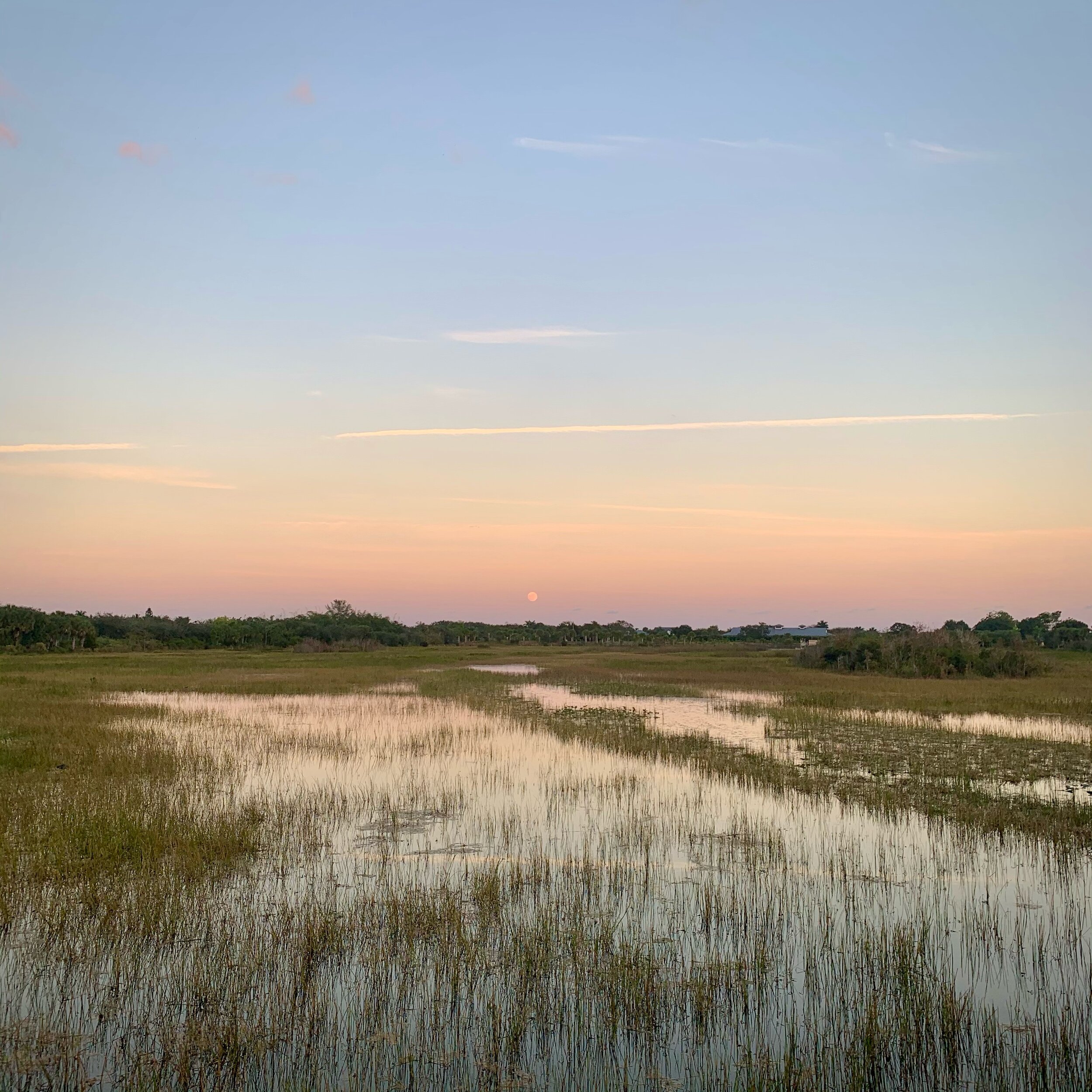
This morning I put in almost 10,000 steps, slowly exploring the Arthur R. Marshall Loxahatchee National Wildlife Refuge. According to their website, “the refuge consists of 145,188 acres, or 226 square miles, of Everglades ecosystems including a mosaic of wet prairies, sawgrass ridges, sloughs, tree islands, cattail communities, and a 400-acre cypress swamp. These lands provide habitat — food, water, shelter, and space — for more than 250 species of birds, 60 species of reptiles and amphibians, 40 species of butterflies, and 20 types of mammals.” My main goal was bird watching, but I did happen to spot two alligators sunning on mud.

If you are interested, I will talk about the birds that I saw and anything notable while encountering them. The most prevalent and numerous were the Common Gallinule, American Coot, and Purple Gallinule. More than once I was startled by their alarming calls from the water line very near my path. When not reacting to me they were swimming around like ducks and eating vegetation from underwater. The Purple Gallinule reminded me of a very large pigeon in shape and the iridescent coloring of their feathers.

The largest birds descending in size were the Great Blue Heron, Great Egret, Anhinga, and Little Blue Heron. They were mostly out in the open and easy to observe. The Anhinga in particular really surprised me. I heard a splash and turned around to see 10 inches of its head above water, with a small fish skewered on the end of his upper bill. He then submerged for 10-15 seconds, came back up, and then seemed to disappear underwater, not to be seen again. It was hard to believe I was seeing a bird that stays underwater that much. Makes sense someone nicknamed it “Snakebird,” because that is how it looked.

There were a few birds that I was not able to identify. The more I get into birding the more I realize there is to learn. But when you love something and it is exciting the motivation is there. The last bird I will mention from this part of the refuge is the Loggerhead Shrike. What a handsome predatory songbird, mostly gray coloring, with black and white, and a precise mechanical song.


The Cypress Swamp at Arthur R. Marshall Loxahatchee National Wildlife Refuge.

The last area I visited was the 400-acre cypress swamp, a small vestige of its historical range before Florida was transformed into what it is today. It’s an area covered in shallow water, with Cypress Trees, ferns, Spanish moss hanging everywhere, lichens, and all other sorts of swamp plants. It was eerily quiet while I navigated the constructed boardwalk, and I imagined how it might be much more active and noisy at night. Just when I had about given up seeing any birds, I was surprised by the appearance of three different types of woodpecker in a matter of minutes. A Pileated Woodpecker, which always seems surprisingly large, a male and female Red-bellied Woodpecker pair, and what I think was a Yellow-bellied Sapsucker. What a great way to spend half my day!


The Box Photo

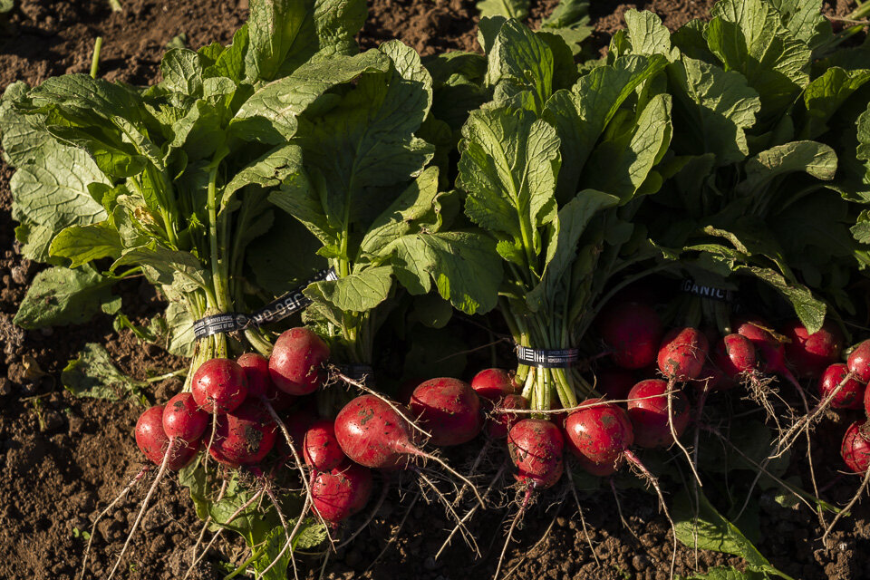
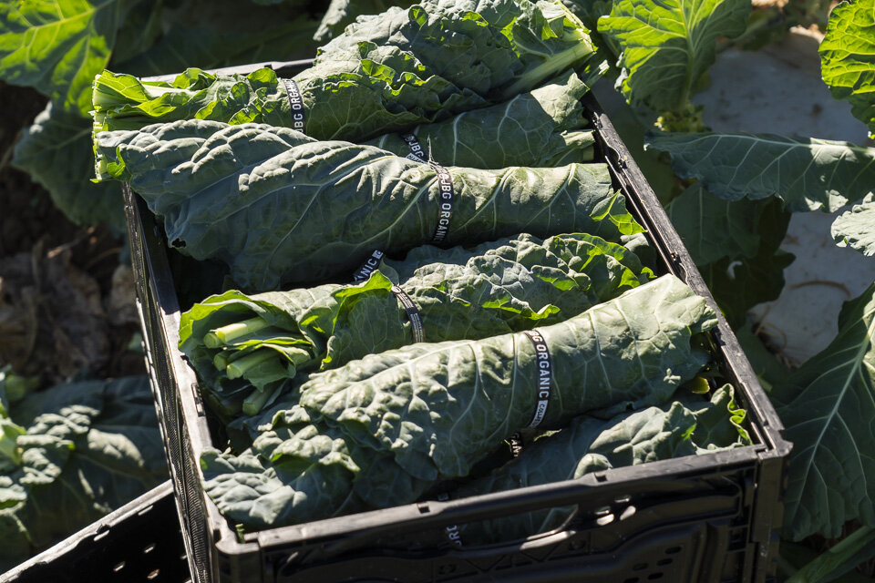
One of the images that I create for Johnson’s Backyard Garden every week is called the box photo. It is intended to illustrate to the CSA members what they might be getting in their share. Here is a description from the JBG website that describes what the CSA is if you are not familiar.

“What is Community Supported Agriculture?

Community Supported Agriculture is much different than going to the local grocery and buying your vegetables. It is a direct partnership between you the consumer and our farm. CSA members pay in advance for a share of the upcoming harvest and are ensured high-quality local produce, and we the farm are ensured a consistent market. Produce is harvested directly from our fertile and certified organic vegetable fields located along the Colorado River just East of Austin. Immediately after harvest, we deliver "CSA shares" to our members' homes, offices, and over 30 community pick-up locations all on the same day.”

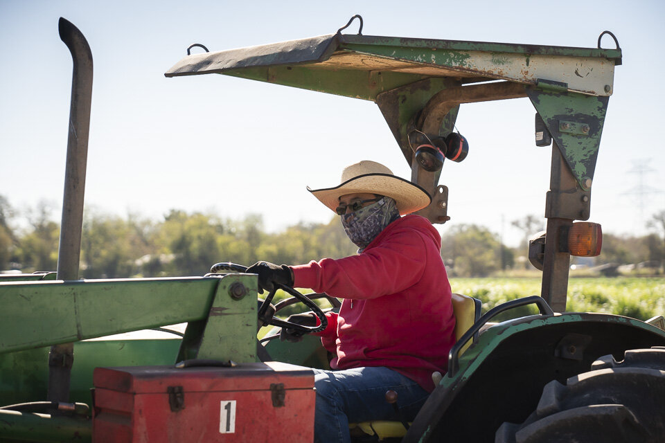
On Tuesday’s you can often find me arranging veggies near the ground and then perched high atop of a 6ft ladder hovering my camera over that week’s gorgeous harvest. After many years of feedback from customers, this seems to be one of their favorite images of mine to see on the JBG website. It has definitely evolved over the years. Here are a few recent ones that I think turned out pretty good.


Photo of me in the cabbage patch by Brenton Johnson, owner of the farm.

Photo of me in the cabbage patch by Brenton Johnson, owner of the farm.


Love U!?

FullSizeRender.jpeg
It’s hard to sustain love for others until we have a sense of inner abundance and sufficiency. When we experience inner impoverishment, love for another too early becomes hunger, for reassurance, for acclaim, and affirmation of our worth. Feeling incomplete inside of ourselves, we search for others to complete us. We can’t claim from others what we cannot give ourselves.
— Real Love: The Art of Mindful Connection by Sharon Salzberg

Saw this graffiti along the Barton Creek Greenbelt under Loop 360 yesterday, and at first viewed it as a compliment from the creator, but then realized it could also be a prescription. And not an easy one in my experience. It sure seems like there are a lot of messages that come from our culture and society that do not prioritize, encourage, or model self-love.


Weekend at the Coast

This weekend I traveled down to the gulf coast of Texas with a friend to do some camping. The choice of where to stay was mostly dictated by the popularity and lack of availability of almost all of the campsites in the whole state. It’s a beautiful time of year to be out of doors. We settled on Lake Corpus Christi State Park, which only had a few spaces left. It would not have been my first choice but it worked out wonderfully and I’m so glad to have expanded my view of how nice the Texas coast can be.

The Corpus Christi downtown bay-front as seen from a deteriorating barrier wall around the marina.

The state park was great and allowed us a home base to explore the city of Corpus Christi and pay a visit to the Padre Island National Sea Shore. The weather was perfect and it was fortuitous to be away from home and outdoors when the election results came in. We watched Biden’s speech at our camp picnic table with a nice fire going. And it was easy to look up and see a hint of the Milky Way, some planets, and lots of stars. All of the other campers were well behaved, which made it very relaxing.

Malaquite Beach at the Padre Island National Sea Shore.

Malaquite Beach at the Padre Island National Sea Shore.

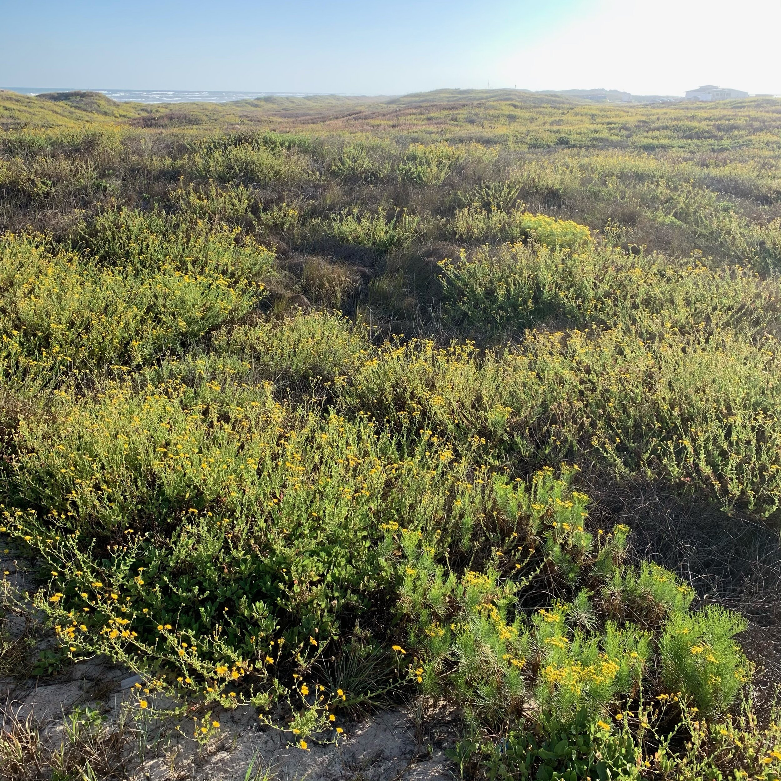
Miles of dunes covered in flowering plants along the beach.

Miles of dunes covered in flowering plants along the beach.

After living in Texas for over 30 years of my life, I lament the fact that I have only been to the coast a very few times. Growing up in central Texas I just never heard anything nice about it. In high school, Padre was the hedonistic spring break destination, which I never participated in. Then you hear about oil spills and the like and it just never sounded that appealing.

Well, I was absolutely impressed with the nature and beaches that I saw and wish now I had made more frequent trips. One thing I love is birding, and at the state park, I saw three gorgeous birds, that you would only see at the southern tip of Texas and into Mexico. The tropical Great Kiskadee and Green Jay, plus an uncommon Audubon’s Oriole. So colorful and exciting to behold!

There aren’t a lot of photos to share since my intention was to mostly stay off my phone and just have an experience. It’s interesting being a photographer because people often assume you will prioritize capturing the most amazing images wherever you go. Maybe some do, but I was just happy to get out into nature and look, listen, breathe, and be. I highly recommend it.


West Texas Panoramas

A few weeks ago I made my first road trip of the year, out to West Texas. Specifically the towns of Marfa, Fort Davis, and the surrounding spacious desert landscape. After being cooped up in Austin all year I was ready to change my environment and find some room to think and have some new experiences. This will be the first of a series of posts about that trip.

Panoramas are one of my favorite photography formats, and I love how easy they are to make with an iPhone. All four mornings that I was on my trip I went hiking on a different Davis Mountain trail. The weather was glorious and it felt invigorating to be moving freely and peacefully out in nature. I find it healing to spend time away from modern life in a place that is raw and wild. My biggest thrill is observing and experiencing the diverse birds, animals, plants, and trees that grow uniquely in these kinds of spaces. To just exist somewhere without distraction or anything manufactured is I think a gift.

Davis Mountains State Park looking from the Indian Lodge Trail towards the McDonald Observatory.

Point of Rocks Roadside Park east of Fort Davis on 166. Every trip out west I make a point to climb up and sit for a few hours, write, think, and enjoy the long view.

Davis Mountains State Park looking west from the Skyline Drive Trail.

A hazy view from the Tall Grass Loop Scenic Overlook at the Fort Davis National Historical Site. Something interesting I learned was that the row of buildings you see at the center of the image and the row of foundations to their right, were aligned separately to magnetic north and geographic north at different times.